Energy industry software
Identify your preferred option quicker.
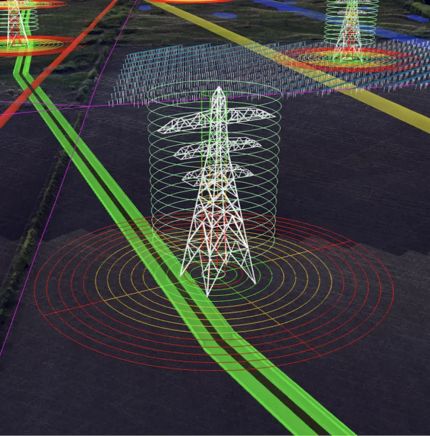
Leverage your existing software ecosystems and data sets by presenting them in context of the real world. This gives teams an enhanced understanding of plans and the ability to spot clashes early.
We’re here to support energy projects
325+
40+
60 secs
$250bn
Assess how topology affects plans from your desk
Teams can overlay project designs and comment directly on plans. This helps your team to identify and mitigate risk more effectively, leading to safer worksites and better cost certainty.
Once we got into more technical option selections, we were able to get cut and fill volumes within 5 minutes, which would have taken months or likely never without Sensat.

Engage with landowners and make them project allies
Pull up Sensat to support public consultation meetings. Showcase constraint information to explain rationales and the extensive considerations you take in planning to turn stakeholders into project allies.
Being able to explain the project visually in 3D meant people were more engaged. It was much clearer for everybody.


