Tackling Storm Overflow Pollution: A Practical Guide for AMP8
A practical guide to understanding what’s really driving pollution events, and how water companies are finding new ways to get ahead of them.
Who this guide is for: Infrastructure planners, environmental leads, digital delivery teams and strategy leaders navigating AMP8, PR24 and the wider drive toward pollution reduction.
Why storm overflow pollution is under the spotlight
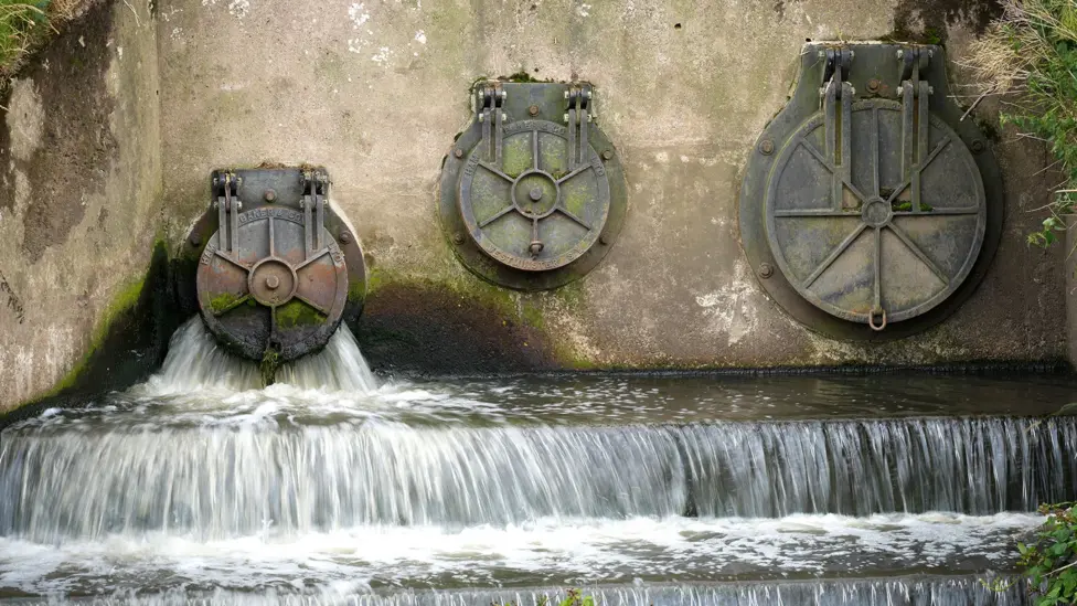
Storm overflows are now a central focus in the UK water sector—driven by increased rainfall, ageing assets, and intense regulatory demands. In 2023, England’s combined sewer overflows (CSOs) discharged for a total of 3.6 million hours - a 105% increase on the previous year, according to the Environment Agency. That trend has reportedly continued, with BBC News recently highlighting that the latest Environment Agency figures show serious pollution incidents rose significantly again in 2024.
This poor performance has made overflows one of the most visible and scrutinised challenges facing the sector. The public pressure and increased regulatory oversight are reflected at the highest levels of government, as detailed in official documents like the House of Commons Library’s briefing paper on the issue, which confirms the scale of political concern.
This pressure has been translated into a formal, legally binding government strategy, the Storm Overflows Discharge Reduction Plan, which sets tighter, mandatory targets for the industry to meet by 2050. With this plan in place, companies are under more pressure than ever from Ofwat and the Environment Agency to reduce pollution events and restore trust.
What’s driving pollution events and why it’s so hard to predict
Combined sewer overflows (CSOs) are designed to relieve pressure during heavy rainfall. But as urban surfaces harden, infiltration increases and networks struggle to cope, these overflows are happening more often. The Environment Agency, which monitors these events, identifies these exact causes in its official Event Duration Monitoring (EDM) data releases, explaining how population growth and impermeable surfaces overwhelm the Victorian-era sewer system during rainfall.
Key challenges include:
- Highway runoff and impermeable surfaces increasing inflow
- Incomplete visibility of network capacity and asset condition
- Limited data integration across catchments and teams
- Delayed interventions due to manual, disconnected reporting cycles
What needs to change and where the sector is making progress
Water companies are starting to rethink how they manage overflow risk. This shift is being driven by the regulatory framework for the next five years (2025-2030), known as AMP8, which is laid out in Ofwat’s Price Review 2024 (PR24). This review sets the funding, performance targets, and significant financial penalties for the AMP8 period to ensure companies deliver on the national reduction plan.
Companies are making progress by:
- Moving from data collection to decision support
Raw data is no longer enough. Teams need tools that turn disparate datasets (like rainfall intensity, asset age, and ground permeability) into a visual understanding of where risk is building. - Breaking down organisational silos
Pollution response involves multiple teams: ops, strategy, field contractors, and regulators. Shared visibility and collaborative workflows are becoming essential. - Embracing predictive approaches
Using historical and geospatial data to model where future overflows might occur is emerging as a powerful strategy. This drive for innovation is being actively funded by the regulator through the Ofwat Innovation Fund, which has awarded millions to projects using AI, predictive analytics, and sensor networks to prevent pollution.
How one sprint helped uncover new possibilities
In July 2025, Sensat and Northumbrian Water co-ran a design sprint encompassing a focused, four-day collaboration designed to tackle complex problems. This exact type of collaboration is the core purpose of Northumbrian Water's annual Innovation Festival, which brings together tech partners to tackle major challenges in focused sprints.
We brought together environmental specialists, asset managers, digital leads and more to explore one central question: Can we use geography and aerial imagery to predict the next pollution spill before it happens?
Working in three cross-functional teams, we:
- Investigated real spill cases
- Built prototype data models and workflows
- Tested ideas around early warning indicators, predictive mapping, and visibility tools
The result? A clearer picture of what’s blocking progress and how we can possibly move past it.
Where digital tools can help
From the sprint and beyond, one pattern was clear: teams need clearer ways to see and act on risk. This is where geospatial visualisation platforms like Sensat are making a difference.
With the right platform, teams can:
- Combine datasets into a single view of network risk
- See how factors like infiltration, road drainage, or maintenance delays affect performance
- Build digital twins of high-risk areas to test interventions before committing to physical works
Key takeaway: You can’t fix what you can’t see
Storm overflows are no longer just a data or compliance issue, they’re a visibility issue. The sector is collecting more information than ever, but the challenge now is making that information meaningful, actionable, and shared across teams. That’s where the biggest breakthroughs are happening.
When frontline teams, digital leads and strategy owners can see the same risks in the same place, they can finally start working proactively, not reactively.
Prediction starts with visibility. And visibility starts with better tools.
Download the Full Sprint Report: How Collaboration and Geospatial Innovation Could Stop the Next Spill
Get the full summary from Sensat and Northumbrian Water’s four-day sprint at the 2025 NWG Innovation Festival.
See how cross-functional teams tackled real-world pollution challenges, built working prototypes, and tested new ways to predict the next spill using geospatial data and visualisation tools.
What’s inside:
- A behind-the-scenes look at the full sprint process
- Key challenges and breakthroughs from real spill scenarios
- Visuals of prototype tools and workflows
- Takeaways from asset leads, digital teams and environmental specialists
- What worked best — and what still needs work
Fill in the form (below) to get your copy
Download the sprint summary
