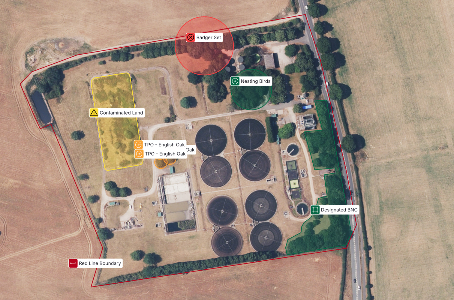
The project site sat in a historical coal mining area, creating hidden risks below ground. These risks were known in theory, but difficult to understand in practice because information was scattered across systems.
Project teams were working with:
• Coal Authority data
• Geological surveys
• Underground utilities
• CAD models
• PDFs, GIS screenshots, and shared drives.
This made it hard for the PM to confidently explain site risk, slow to get alignment across teams, and easy for critical issues to surface too late.
Before Sensat, understanding the site meant:
• Long meetings to explain constraints
• Specialists working from different views of the same data
• Repeated clarification and rework
• Designs progressing without shared confidence
This ultimately led to the initial design being rejected.
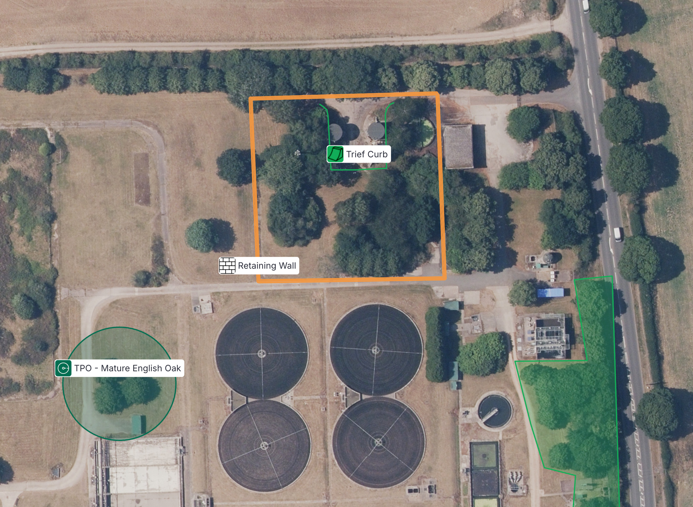
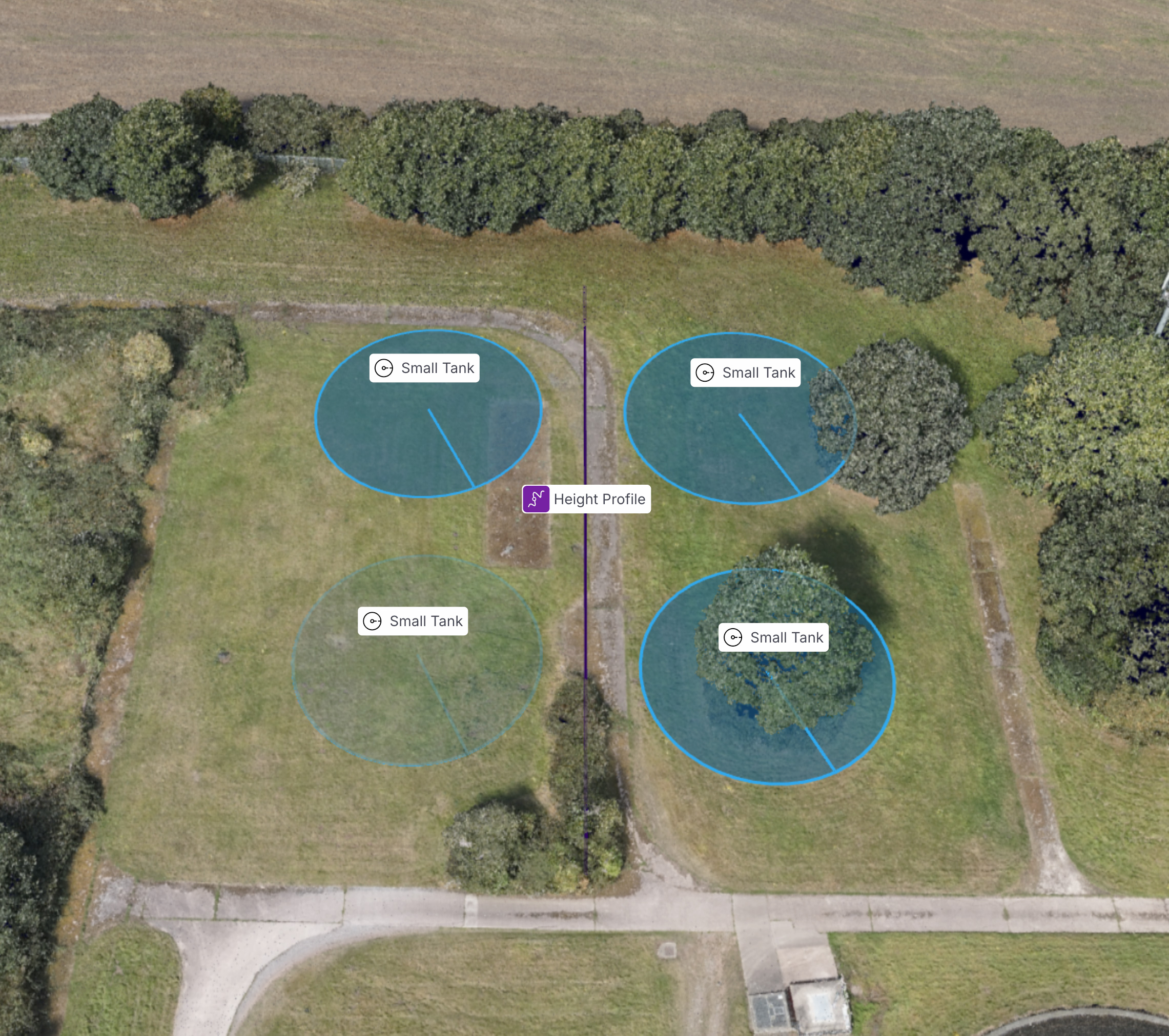
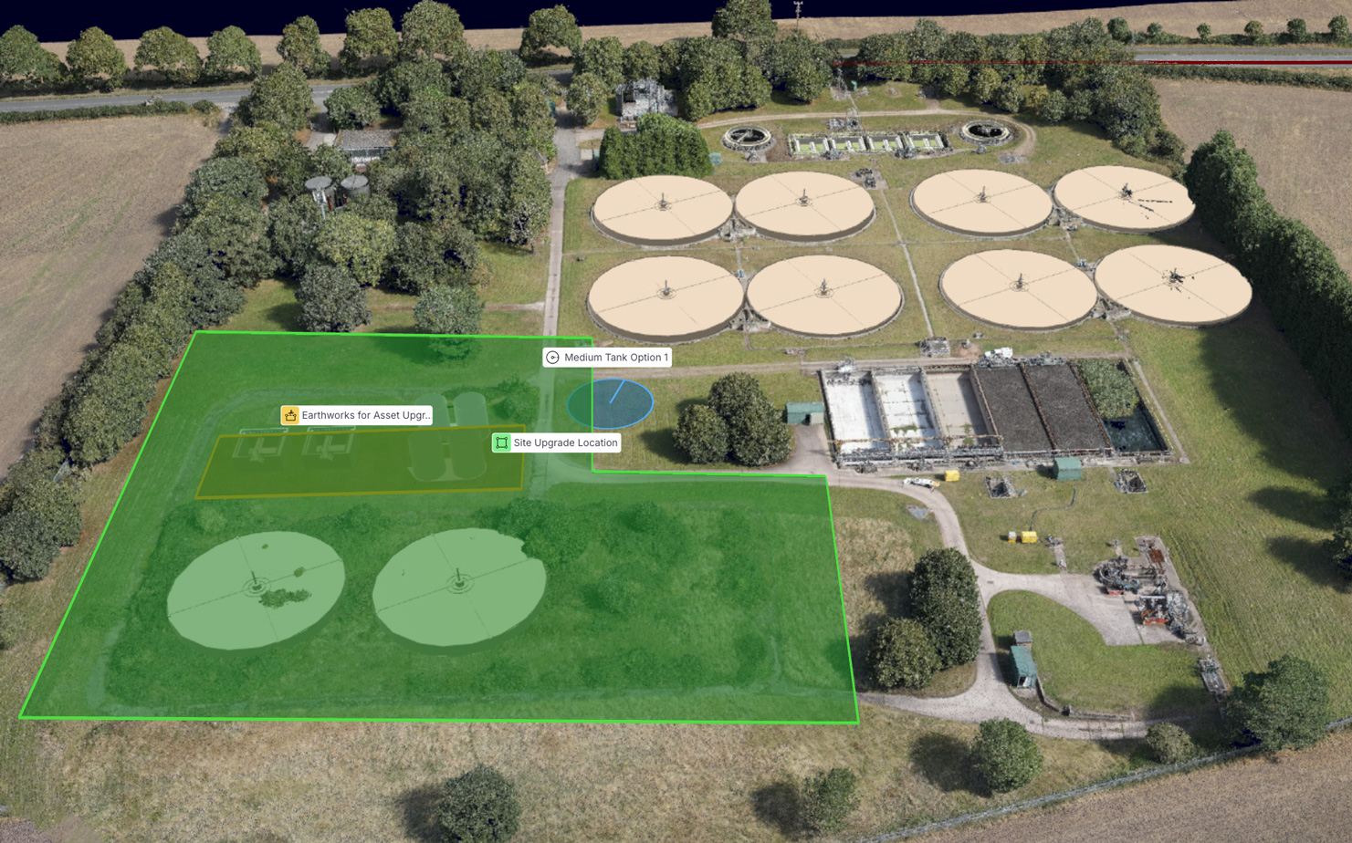
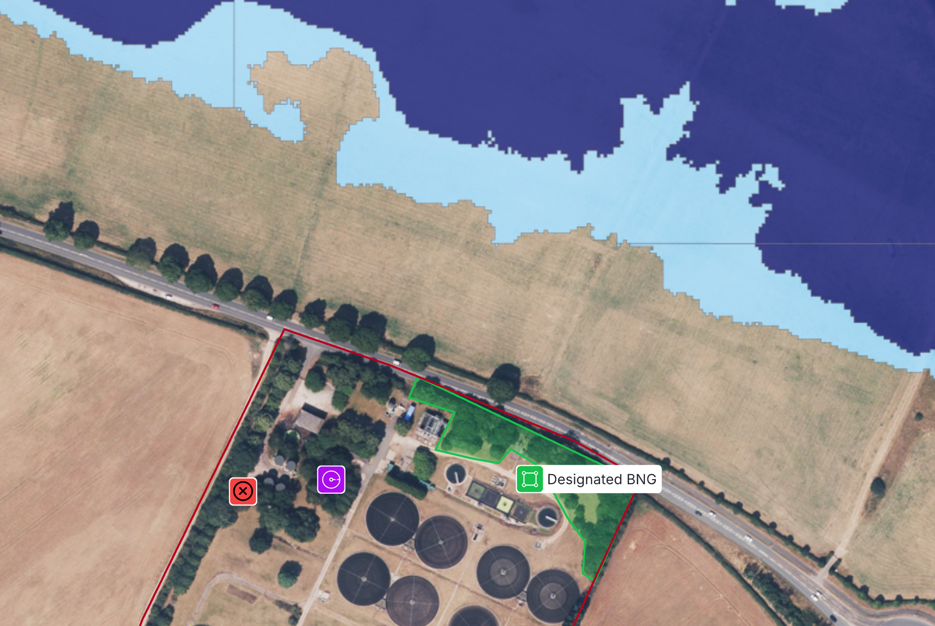
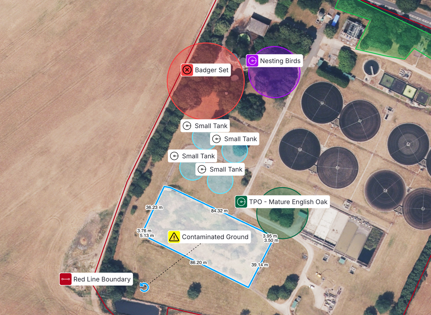
The delivery team used Sensat to bring all relevant site data into a single visual view, overlaid on real-world context. This included:
• Coal Authority and geological data
• Underground utilities
• Design models
• Topographical and LiDAR surveys
Instead of chasing information, the PM could see and show the full site context in one place.
For the project delivery team, Sensat wasn’t another system to manage. It became the place to understand the site, explain risk, and keep the project moving.