Early-stage optioneering had become a major bottleneck.
To identify suitable locations for CSO tanks, teams needed to consider:
- Geology and ground conditions
- Topography and constraints
- Existing assets and utilities
- Prior studies and survey data
The information existed, but it lived across different systems, files and teams. With no shared view, feasibility could only be judged one site at a time. Specialists spent time assessing locations that were later ruled out, site visits were booked before basic viability was clear, and cross-functional teams couldn't get a clear view of feasibility early.
Confirming even basic constraints meant pulling data together by hand and visiting sites multiple times - often just to establish why a location wouldn't work at all.
Against a strict 700 tank target, a process this slow and manual, put the delivery timeline at risk.
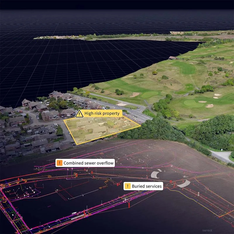
One shared view for early option selection
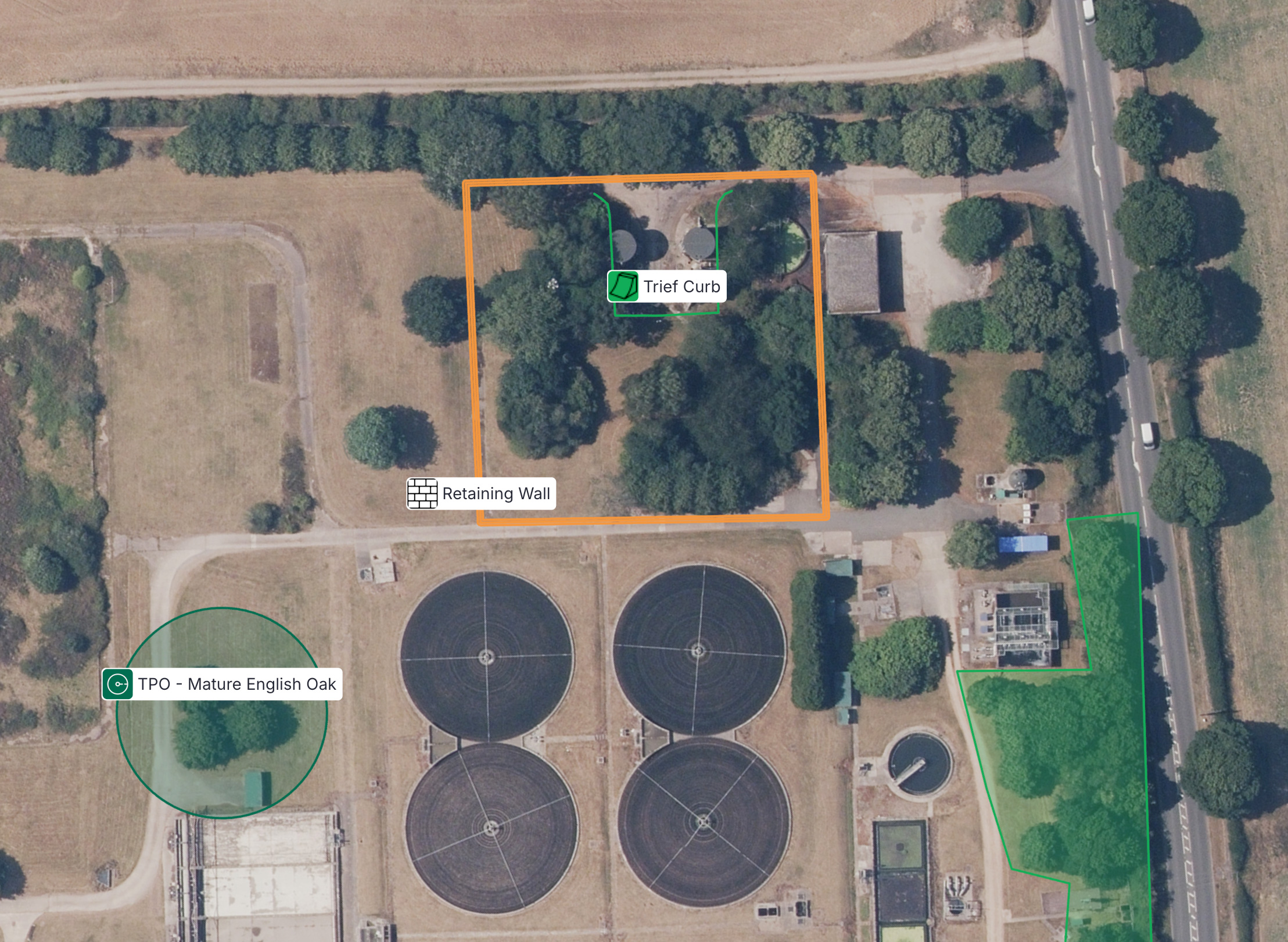
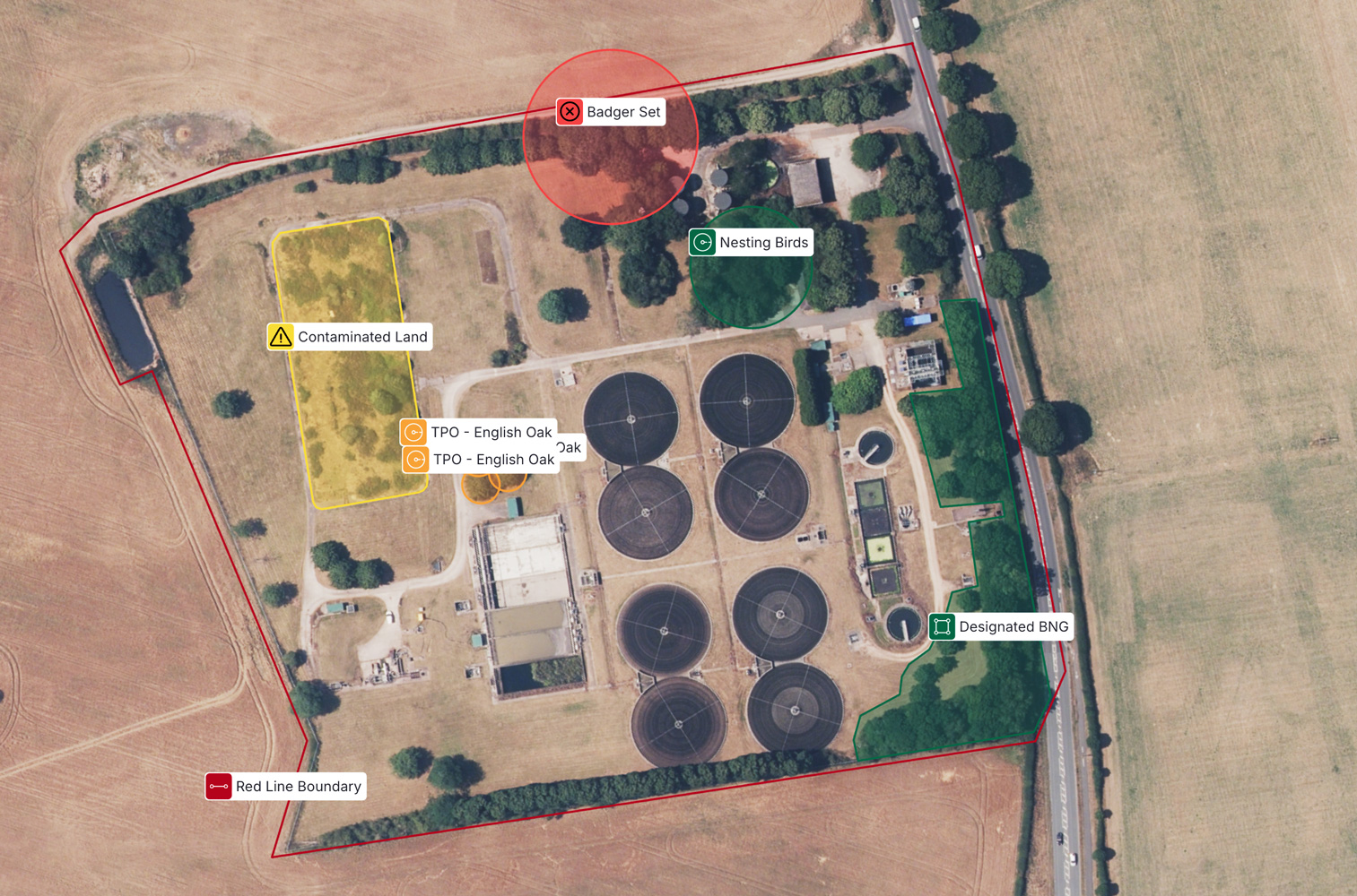
The teams used Sensat to visualise large areas of the catchment in a single, shared view.
They brought together:
- Geology and ground investigation data
- Topography and environmental constraints
- Existing assets and underground utilities
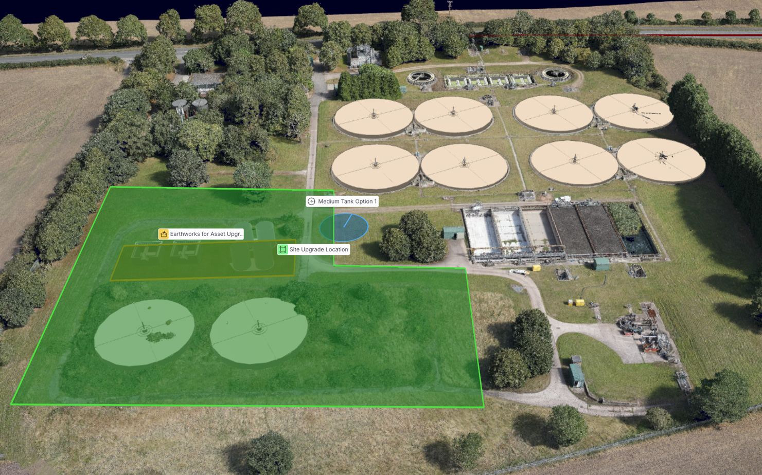
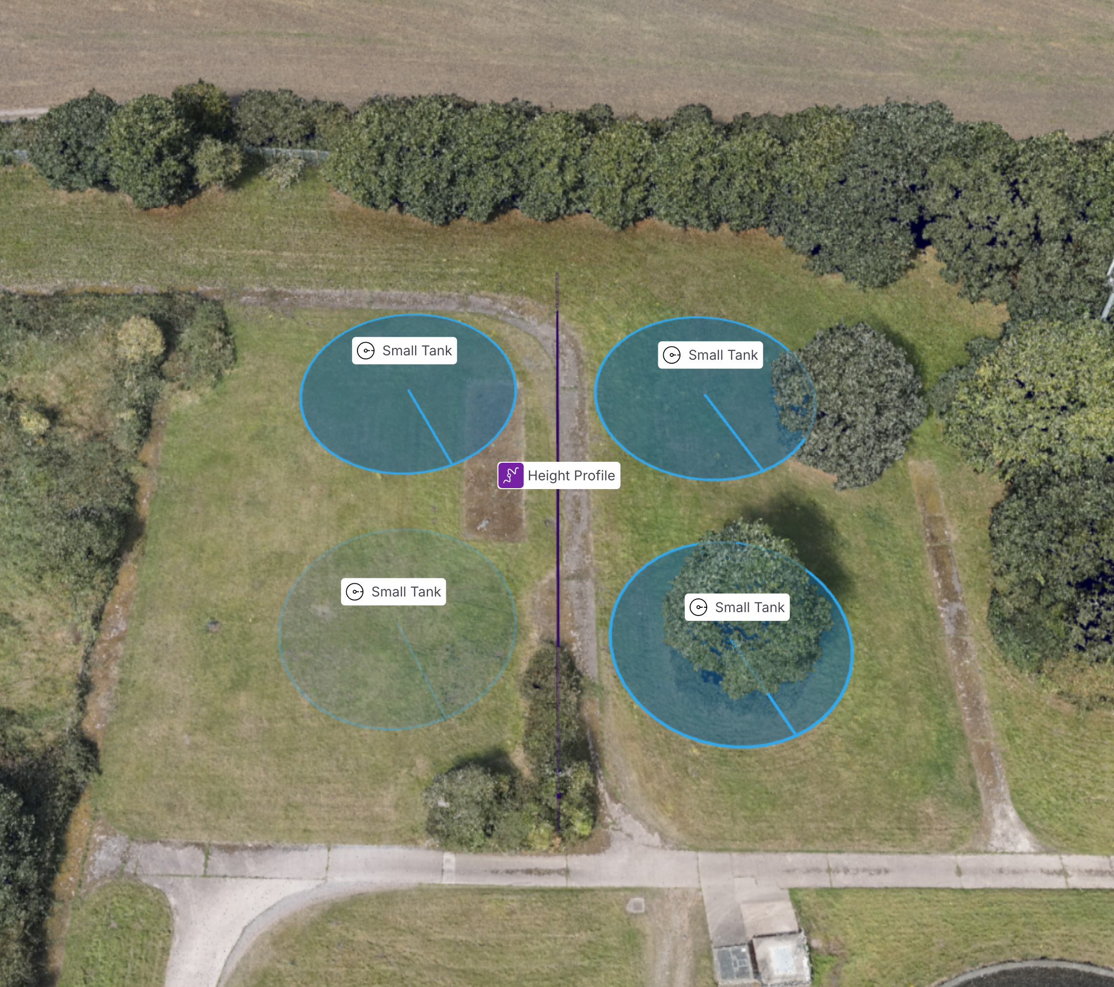
- Different sizes and locations on site for the storage solutions
This allowed PMs and specialists to assess multiple potential sites from their desks and compare options side by side.

For the Operations and Engineering teams, Sensat was not about producing a better visual. It was about removing friction early, to hit the ambitious target: 700 storage tanks, sited and delivered in 3-6 months. The old way of working wouldn’t be able to meet that.
By speeding it up, the team delivered to schedule, cut wasted effort and put resources where they had the most impact.
Where this approach works best
- Siting new storage or assets across many candidate locations
- Early-stage optioneering and feasibility
- Catchment-wide planning exercises
- Projects where site visits are costly or slow to arrange